About
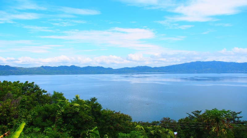
The only true inland lake in the country is located in the Ashanti region. It is an awesome place to relax and enjoy nature. The lake has no surface outlet and is located in a meteorite impact crater measuring 19 square miles (49 square km) and 230–240 feet (70–73 metres) deep. The lake is surrounded by lush mountains and fed by small streams that tumble down the crater’s steep sides (500–1,400 feet [150–425 metres] above water level).
Situated in the Ashanti region of Ghana, Lake Bosomtwe is one of six UNESCO-designated biosphere reserve sites. It is one of three such internationally recognised sites in the country – Bia in the Western, and Songhor in the Greater Accra Region.

The southernmost section of the site overlaps the northern section of the Bosomtwe Range Forest Reserve, creating a combination of forest, wetland and mountain ecosystems. The biosphere reserve sustains 35 tree species, including some used for timber. The site is also home to a great diversity of wildlife and a population of over 50,000 inhabitants, whose main economic activities are farming, fishing, and tourism, as the lake is a major national tourist destination. The area is widely used for research, especially on climate change, as well as environmental education for schools and universities.
Location
Latitude: 6°24’35” N – 6°35’33” N
Longitude: 1°19’22”W – 1°29’30”W
Midpoint: 6°30’16”N – 1°24’31”W
(Source:Unesco.org)
History
Bosomtwe is a circular lake caused by a meteor impact a million years ago. The sides rise steeply, covered with trees and bushes. There are various settlements around, mainly fishing and farming villages, as well as some places to stay. Lake Bosomtwe, also sometimes spelt Bosomtwe, is a lake formed by an ancient meteorite strike in the Ashanti Region.

Oral tradition has it that the lake was formed in 1648 when a hunter pursuing an antelope shot and injured the antelope “Otwe” in the Twi dialect. The antelope, however, continued its run until it disappeared in a small pond ahead. The said hunter, by the name Akora Bompe, in shock, decided to stay beside the pond and never returned to his town of Asamang. He then named the place “Bosomtwe”, which in English translates to “antelope god”. He believed the water was a god and saved the antelope’s life.
Each village in the lake area has its own shrine or fetish grove. With the arrival of Christianity, some people lost their belief in those traditions, but nonetheless, many still worship these gods for help in bad times or against diseases.
Currently, about 23,000 people live in the 27 lake communities. Each village around the lake has its own shrine, and many visit to seek spiritual help.
There is a stone at the lakeside called the Abrodwum Stone, believed to be the spiritual centre of the lake. Usually, whenever there is a poor yield, it is considered a bad omen; thus, sacrifices would have to be made.
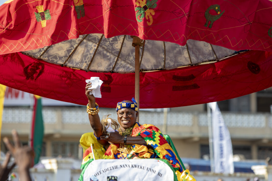
This deed is undertaken in the presence of the Asantehene. In the ceremony, the cow’s innards are offered to the stone, and the rest is thrown into the water. It is a spectacular sight to see the crowd rush into the water, armed with cutlasses and axes, to take their share of the meat.
Considering the above belief, Lake Bosomtwi is held sacred by Ashanti traditionalists, though the finer details of its exalted status are rather elusive. Some claim that Bosomtwi is the home of a deity called “Twi.”
Others believe that it is visited by the souls of the departed on their passage to eternity. It is also the sacred water body of Bosomtwi, one of five divisions in the matrilineal Nton system, which the Asante and other Akans believe passes a father’s attributes to his children.
In former times, it was taboo to touch water with iron objects, so people never used conventional boats. To date, they move on the lake using the “padua”, a wooden plank that requires a lot of skill to handle properly.
It must be admitted that it is not clear whether the crater in which Bosomtwi lies is volcanic in origin, was formed by a meteorite or is a small pond. Either way, the lake is a beautiful spot, encircled by mountainous, thickly vegetated crater walls rising several altitudes. This presents ample opportunities for walking, birding, fishing, hiking and canoeing.


What to do
There is an information centre where you can learn about the lake and conservation efforts and arrange a boat trip on the lake. If you are lucky, someone will open a coconut or two for you for a few cedis.
It is possible to take boat rides on the lake, swim, and hike around. The various communities around the lake are very welcoming. There are also some great hikes up into the hills and the sacred areas around villages.
Videos
MAP
https://visitghana.com/%22https://www.google.com/maps/embed?pb=!1m18!1m12!1m3!1d63425.99641491564!2d-1.4442254572361284!3d6.505885545201817!2m3!1f0!2f0!3f0!3m2!1i1024!2i768!4f13.1!3m3!1m2!1s0xfdbf126a3a9b7ed%3A0x71af797860ef1718!2sLake+Bosomtwe!5e0!3m2!1sen!2sgh!4v1541392266046%22
https://visitghana.com/%22https://www.google.com/maps/embed?pb=!1m18!1m12!1m3!1d62269.79335526874!2d-1.4442254572361284!3d6.505885545201817!2m3!1f0!2f0!3f0!3m2!1i1024!2i768!4f13.1!3m3!1m2!1s0xfdbf126a3a9b7ed%3A0x71af797860ef1718!2sLake+Bosomtwe!5e1!3m2!1sen!2sgh!4v1541396763417%22
Getting there
There is a tarred road that gives access to the lake from the direction of Kumasi; it rises in elevation around the lake’s rim and descends into the lake, ending at the first village, Abono. There is a small fee to pay at a community-maintained entry point.
It is considered taboo to use a regular dugout canoe or to have metal or iron touch the lake surface (i.e., modern boats, even though a couple traverse the lake); because of this, a very different type of boat is used by the fishermen on the lake. It is a large plank of wood that they sit on top of and use their hands, or plates in their hands, to propel themselves.
The lake level continues to rise, so the villages have had to keep moving up the hillside. You will notice that the villages often have a number after their names, indicating how many versions of the village there have been. You will see tree trunks coming out of the water because of this.
Nearby Attractions
- Manhyia Palace Museum
- Rattray Park
- Kumasi City Mall